

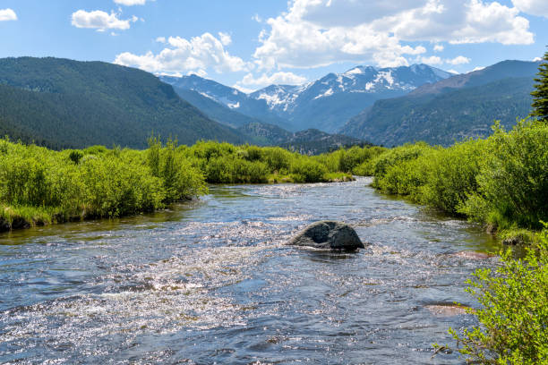
Quick answer: The Big Thompson River originates in Forest Canyon, a remote glacially carved valley below Trail Ridge Road, and flows 78 miles before joining the South Platte River near Greeley. The Fall River originates near the Alpine Visitor Center at Fall River Pass, flows about 17 miles through Horseshoe Park and the town of Estes Park, and joins the Big Thompson River just east of town. Neither headwater area has a maintained trail leading directly to its exact source, though both can be viewed or approached from nearby vantage points and trails.
Every visitor to Estes Park crosses these two rivers dozens of times without necessarily knowing where the water actually comes from — or where it eventually goes. Both rivers begin as snowmelt within a few miles of each other on Trail Ridge Road, and both end up hundreds of miles away on the Great Plains, but the paths they take, and how close you can actually get to their origins, differ quite a bit.
The Big Thompson River: Born in Forest Canyon
The Big Thompson River’s headwaters begin in Forest Canyon, a deep, glacially carved valley that Outside magazine once called Colorado’s “grandaddy of canyons.” The river starts as rivulets of snowmelt collecting on the Continental Divide at roughly 11,310 feet, then flows through the canyon and east into Moraine Park, one of the most popular meadow-and-wildlife viewing areas in Rocky Mountain National Park. From there, it continues into the town of Estes Park, where it’s held by Olympus Dam to form Lake Estes before continuing down through the dramatic, 25-mile Big Thompson Canyon toward the plains.
Can you hike to its source? Not really, at least not down into the canyon itself. Forest Canyon has no official maintained trail into its interior — the canyon floor is choked with brush and fallen timber, sunlight only reaches it for a few hours a day, and the National Park Service’s own guidance treats it as a genuinely off-trail wilderness route rather than a hike. The most experienced backcountry hikers sometimes bushwhack in from the Fern Lake Trailhead, but this is not something recommended for casual visitors. Instead, nearly everyone experiences Forest Canyon and the Big Thompson’s birthplace from above: the Forest Canyon Overlook on Trail Ridge Road, a short, paved, five-minute walk from the parking area to an observation platform at 11,716 feet, looking directly down into the canyon and toward the peaks of the Continental Divide where the water originates.
Where does it end up? The Big Thompson flows a total of about 78 miles, passing through Estes Park, down Big Thompson Canyon along U.S. Highway 34, and out onto the plains near Loveland, where it eventually joins the South Platte River a few miles south of Greeley. From there, its water becomes part of the massive South Platte–Platte–Missouri–Mississippi river system, ultimately reaching the Gulf of Mexico. The Big Thompson watershed covers roughly 900 square miles and supplies drinking water to an estimated 800,000 people along Colorado’s Front Range.
The Fall River: Born Near the Alpine Visitor Center
The Fall River begins its 17-mile run near the Alpine Visitor Center, close to Fall River Pass on Trail Ridge Road — one of the highest points reachable by car in the entire National Park System, at nearly 11,800 feet. From there, the river tumbles down through the Fall River valley, past the Alluvial Fan (site of a dramatic 1982 dam-break flood), through Horseshoe Park, and into the town of Estes Park through the Fall River Entrance corridor, before joining the Big Thompson River just east of town.
Can you hike to its source? Similar to the Big Thompson, there’s no dedicated trail marked specifically as “the source of the Fall River,” but this one is considerably more accessible than Forest Canyon. The alpine tundra immediately around the Alpine Visitor Center and Fall River Pass sits right at the river’s headwater zone, and the short, paved Alpine Ridge Trail near the visitor center lets visitors walk out onto the same tundra where the earliest trickles of the Fall River form. It’s not a hike to a single, marked spring, but it’s a genuinely easy way to stand at the elevation and terrain where the river begins — something the Big Thompson’s headwaters in Forest Canyon simply don’t offer.
Where does it end up? After its roughly 17-mile run, the Fall River joins the Big Thompson River near Estes Park, meaning its water follows the exact same downstream path as the Big Thompson’s — through Lake Estes, down Big Thompson Canyon, and eventually into the South Platte River near Greeley.
Two Rivers, One Destination
Despite starting in different corners of the park — Forest Canyon for the Big Thompson, Fall River Pass for the Fall River — both rivers converge just east of Estes Park and share the same journey from there onward, through the same canyon, toward the same larger river system. In a real sense, everything you see flowing through downtown Estes Park, whether it’s called the Big Thompson or the Fall River at that particular bridge, is headed toward the exact same place: the South Platte, and eventually the Mississippi.
Frequently Asked Questions
Is Forest Canyon open to hikers?
What’s the easiest way to see where the Fall River begins?
Do the Big Thompson and Fall River meet inside the park or in town?
Which river is longer, the Big Thompson or the Fall River?
Part of the Estes Park HQ nature series. See also: Trail Ridge Road: America’s Highest Continuous Highway and Downtown Estes Park: A Local’s Guide to Shopping, Dining, and Fun.