

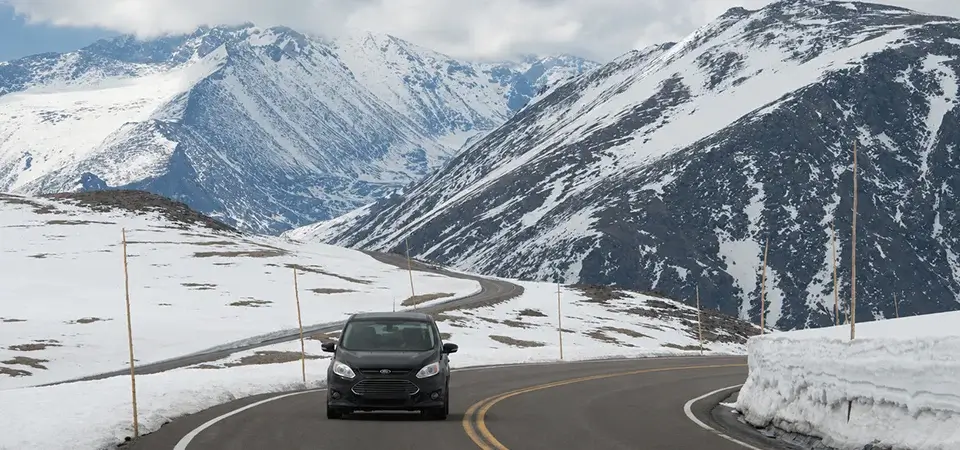
Quick answer: Trail Ridge Road is a 48-mile scenic highway through Rocky Mountain National Park connecting Estes Park to Grand Lake, Colorado. It reaches 12,183 feet — the highest continuous paved road in the United States — and is typically open from late May to mid-October. The drive takes 2 to 3 hours one way with stops, and the best pullouts are Many Parks Curve, Rainbow Curve, Rock Cut, and the Alpine Visitor Center.
If you have time for only one scenic drive during your Rocky Mountain National Park visit, this is it. Trail Ridge Road climbs from the montane forest around Estes Park, through subalpine meadows, and above treeline into genuine arctic tundra — the same ecosystem found in northern Alaska — all without leaving your car.
The Basics
Trail Ridge Road runs 48 miles between the town of Estes Park on the east side of the park and Grand Lake on the west side. It reaches a maximum elevation of 12,183 feet, earning its designation as the highest continuous paved through-road in the country, and roughly 11 miles of it sit above 11,500 feet. Built between 1929 and 1938, it’s now part of U.S. Highway 34 and is listed on the National Register of Historic Places.
Because of its elevation, the road is seasonal. It generally opens around Memorial Day weekend and closes for the winter sometime in October, though exact dates shift year to year based on snowfall — always check current road status before you go, since even mid-summer closures can happen temporarily due to weather.
The Best Stops, East to West
- Deer Ridge Junction (8,937 ft) — the eastern gateway, with views of Longs Peak and the Mummy Range.
- Many Parks Curve — sweeping views back over Horseshoe, Moraine, and Estes Park valleys; a good first stop to acclimate before climbing higher.
- Rainbow Curve (10,875 ft) — views of Horseshoe Park and the jagged peaks of the Mummy Range, including Mount Chapin.
- Forest Canyon Overlook (11,758 ft) — the first above-treeline stop, looking into a classic U-shaped glacial valley.
- Rock Cut (12,110 ft) — the highest roadside stop with a paved trail. The half-mile Tundra Communities Trail here is one of the best easy places in the park to spot yellow-bellied marmots, pikas, and bighorn sheep.
- Alpine Visitor Center (11,796 ft) — the highest-elevation visitor center in the entire National Park System, with exhibits, restrooms, and the adjacent Trail Ridge Store for snacks and warm layers.
- Milner Pass (10,759 ft) — marks the Continental Divide; water on one side flows to the Atlantic, the other to the Pacific.
From the Alpine Visitor Center, the road descends toward Grand Lake through the Kawuneeche Valley, a quieter, less-crowded stretch known for moose sightings and views of the Never Summer Mountains.
Wildlife Along the Way
Planning Your Waterfall Day
- Altitude: Most of the drive sits above 10,000 feet. Lightheadedness and shortness of breath are common, especially for visitors coming straight up from Denver. Drink water and descend if symptoms worsen.
- Weather: Afternoon thunderstorms build almost daily in summer. Plan to be off the highest stretches of the road by early afternoon.
- Timed entry: During peak season, a timed-entry reservation is required to enter the park, and this applies to Trail Ridge Road as well.
- Layers: Even on a warm day in Estes Park, temperatures at 12,000 feet can be 30 degrees cooler with strong wind. Bring a jacket regardless of the season.
Frequently Asked Questions
How long does it take to drive Trail Ridge Road?
Is Trail Ridge Road open in winter?
Do I need a park pass to drive Trail Ridge Road?
Is the drive safe for those afraid of heights or exposed roads?
Part of the Estes Park HQ scenic drives series. See also: Scenic Overlooks and Photo Spots in RMNP and Where to See Wildlife in Estes Park.